In this article, I am going to introduce some advanced project management controls in Geodesignhub. For background about this, please review the project management tools in Geodesignhub. Projects boards are available for all designs in Geodesignhub and with this update there are a few things that are new that help with the management of complex geodesign projects.
Background
Managing different activities on a place over time necessarily means thinking about schedules, workload and most importantly people who in the end will work with the different entities. Any project that is sufficiently complex needs a lot of work and effort to manage. These tools help you in organizing a large project and also co-ordinating activities. From a management point of view, they help in understanding the key areas that need to be staffed and personnel that need support for smooth implementation.
The problem
We use these tools extensively in our projects but to give you a understanding of why this is important, consider this: As a part of the 100 Resilient Cities program, you can see the published resilience strategies in the form of a document archive. A important question is how are these going to be implemented? Do the cities have the organizational capacity to implement these? How do you know which of these interventions are the most problematic or need organizational development. What are the key departments that need to be properly resourced to ensure effective implementation. I am using the resilience strategies just as a example, but these can be used in the context of new transportation, environmental management, disaster recovery and many other domains. How do you move from strategy to implementation? How do you effectively manage the changes? Lets get right into it with a screenshot from a small project:
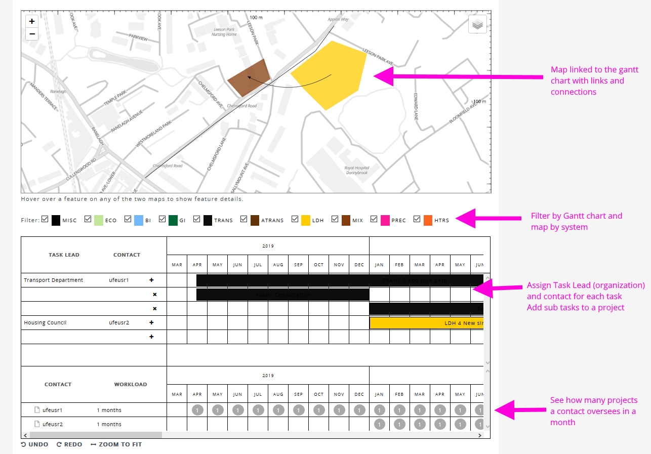
Filter Gantt and map
The boards are available in the “Tasks” section of your project workspace. To begin, just like in other areas of Geodesignhub, now you can filter the Gantt and Map based on the system of interest. You don’t have to worry about displaying all the systems every timeand reduce the clutter and number of items displayed.

These filters work across the projects and the map seamlessly so you can focus on specific systems: e.g. you might want to focus on the connections and scheduling for the “Natural” systems only e.g. Forests and Green Infrastructure and not worry about the built environment.
Task Leads and Contacts
A design generally is a combination of different projects and policies. In a problem that is large enough, there will be multiple organizations who will be incharge of implementing / managing these different projects. You can now add these organizations as task leaders: these are entities or organizations that will be in-charge of implementation of these projects and policies in the geography.

You can add as many entities as possible, even specific departments within them to be precise. By assigning a organization to the project or policy ensures that there is appropriate oversight and you understand how the project will be independent. Once you have added the organizations, you can then assign these to the individual task items.

In many cases while the organization is incharge of implementation, you may need a contact to interact with them, get status and update the rest of the people on the project. In which case you can then assign contacts to the task.

This is especially useful for understanding how the project will be tracked and communicated.
Sub-tasks
A lot of projects need a breakdown of individual actions that help in management of the outcomes. You can now add sub-tasks to projects and schedule them to help breaking down the project into individual components.

Workload
Once you have the project sequenced and tasks and sub-tasks decided, the board will then automatically develop the workload for each of the contacts over the life of the project.

This type of analysis is very useful in estimating the workload, identifying critical organizations and people to ensure that the management and implementation of the project is successful.
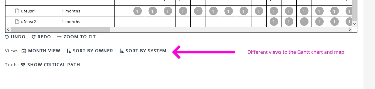
Additional filters
In addition to all the changes we now have additional filters to view and sort the design gantt chart and map.
How is this used?
To effectively manage a complex geodesign problem: one that involves many projects, policies, agencies and actors. co-ordination is critical. Capabilities like the ones described above, help in developing a accurate assessment of capabilities and identifying gaps in the organizational structure associated with implementation of a project.
![]()
![]()