In this article, I will explain how to upload evaluation maps. Once the system is setup in the administration panel, it appears in the “Geodesign” section. This article assumes that you have a GeoJSON evaluation file that needs to be uploaded. If you want to draw the evaluation maps by hand the same procedure applies but instead of selecting “Import external data” you click on the feature that you want to draw.
-
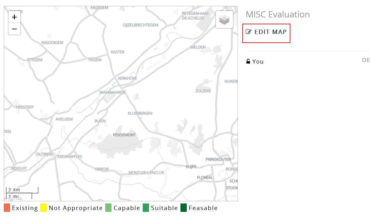
Open the Evaluation map box, it should show a blank basemap. Click on “Edit Map”
-
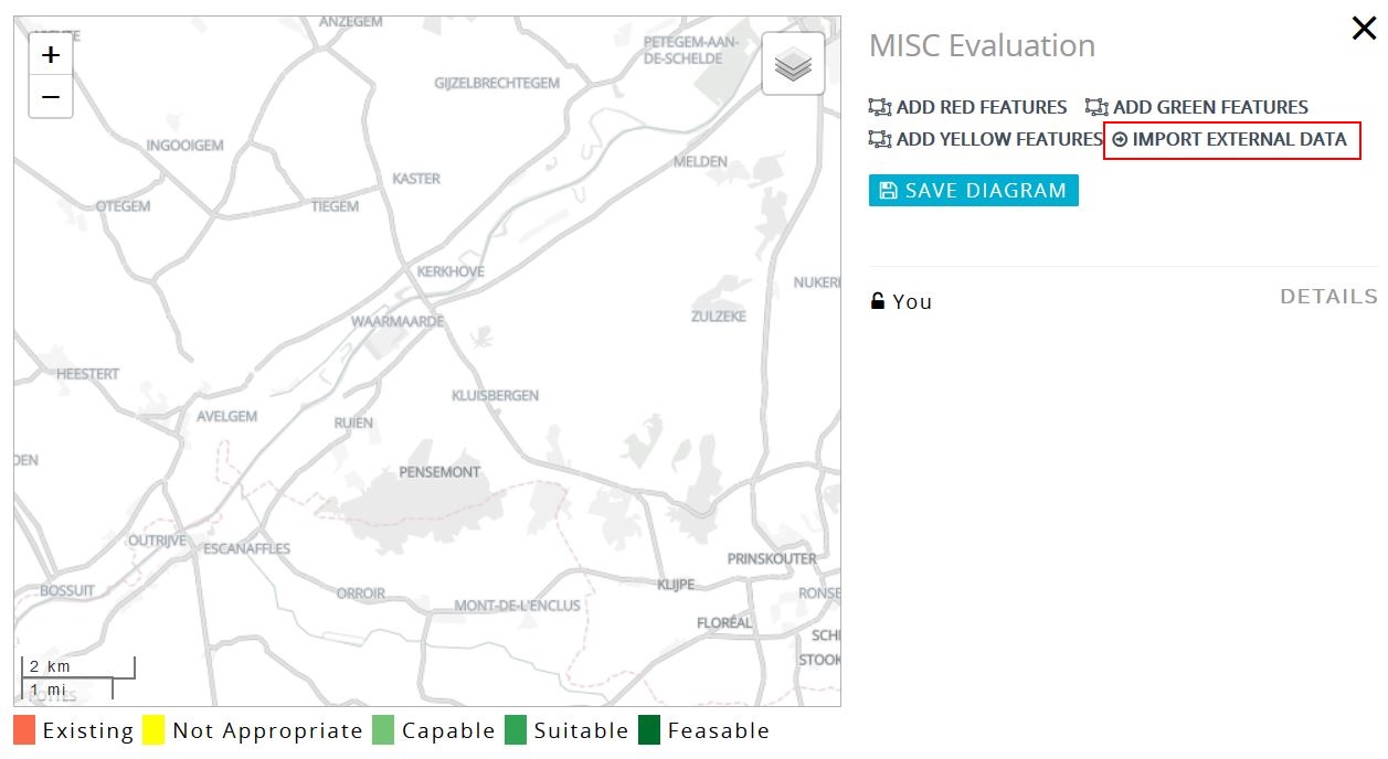
Once you click on the edit map button, a series of controls appear, in this case we are uploading a pre-built evaluation GeoJSON file. Click on the “Import External Data” link.
-
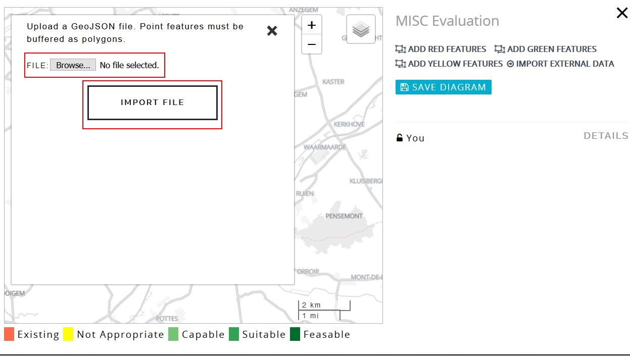
Once the link is clicked, a file upload control is displayed where you will be asked to select the file that you want to upload.
-
Once you click on the file you can then select “Import File” and the data will be imported.
-
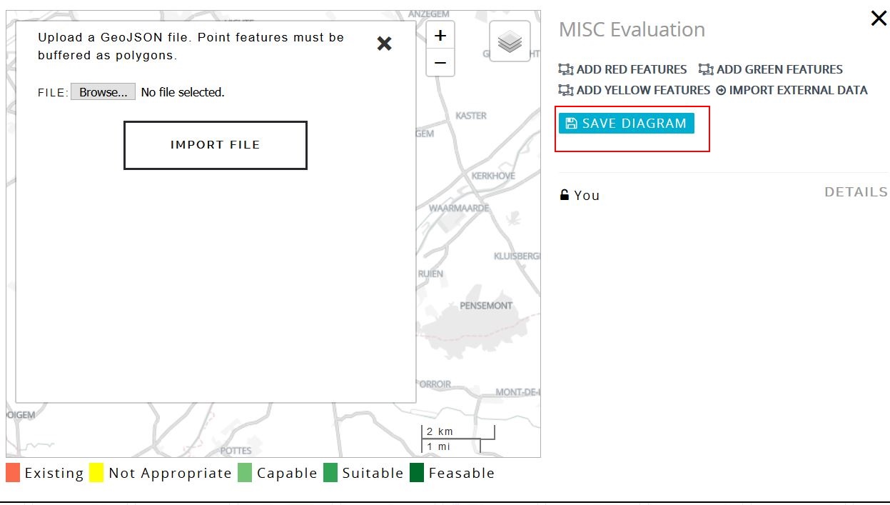
Finally click on the “Save Diagram” button to save the file.
Only evaluation map authors can change / update the evaluation, by default the project administrator who creates the system can upload evaluation map. To enable others to upload / draw evaluation maps, you must first assign them as the author for the evaluation, see this article for further details: Changing author of a evaluation map