Plugin Showcase
Geodesignhub follows Python’s premise of “batteries included”. What it really means is to have a rich, standard functionality that can be utilized without having the user to download various packages or installing software or worrying about software licenses, technical skills etc. This gives Geodesignhub a head start in many projects because the focus is on the problem at hand and not software requirements or technical skills etc. To that end, we have built and maintained a extensive set of plugins and tools. Plugin Showcase is a series of posts that I plan to write over 2019 to introduce the different plugins that are available in Geodesignhub today that you can use for your projects.
3D Viewer
The first plugin that I plan to introduce is one of the earliest plugins that I started to work on! It is the 3D Buildings Viewer: a plugin to view buildings drawn in Geodesignhub in 3D. It is open source 3D viewer for buildings and it was first published on February 2016, it is in continuous development for over two years!
Introduction
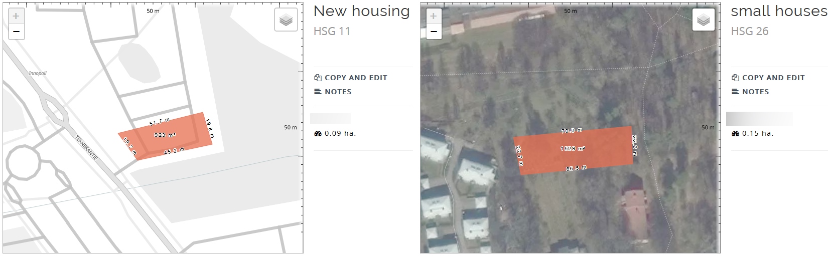
The premise is simple, when a project site is small i.e. a neighborhood or a few blocks, the geodesign “problem” is at a smaller geographical scale. The topic of the conversation around management generally involves specific buildings and sites. Sometimes people talk about changing the facade of a building, changing ownership or constructing some additional extensions or removing / upgrading the building. They represent this by drawing simple 2d polygons like below, showing a couple of houses on a black and white and satellite basemap as below.
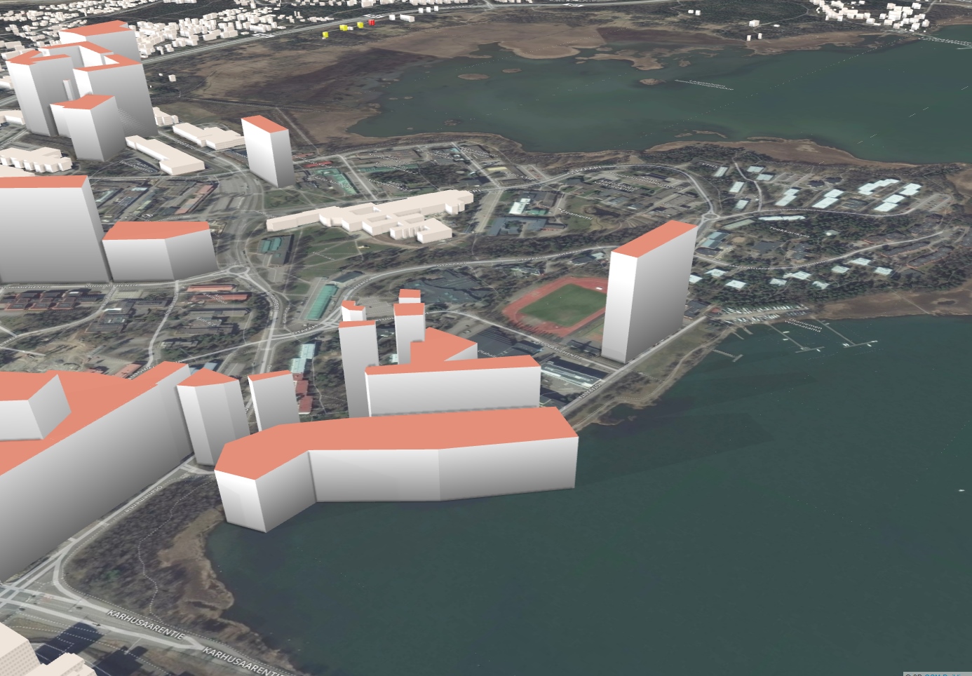
To view these in 3d, these simple houses are “extruded” to generate a height and shown on a 3D environment. In fact you can specify a height it self in Geodesignhub but if you don’t, don’t worry the software assigns a height to you and you can now see the 2d buildings in 3D using the 3D Viewer that can be navigated in 3d using zoom and camera tilt controls..
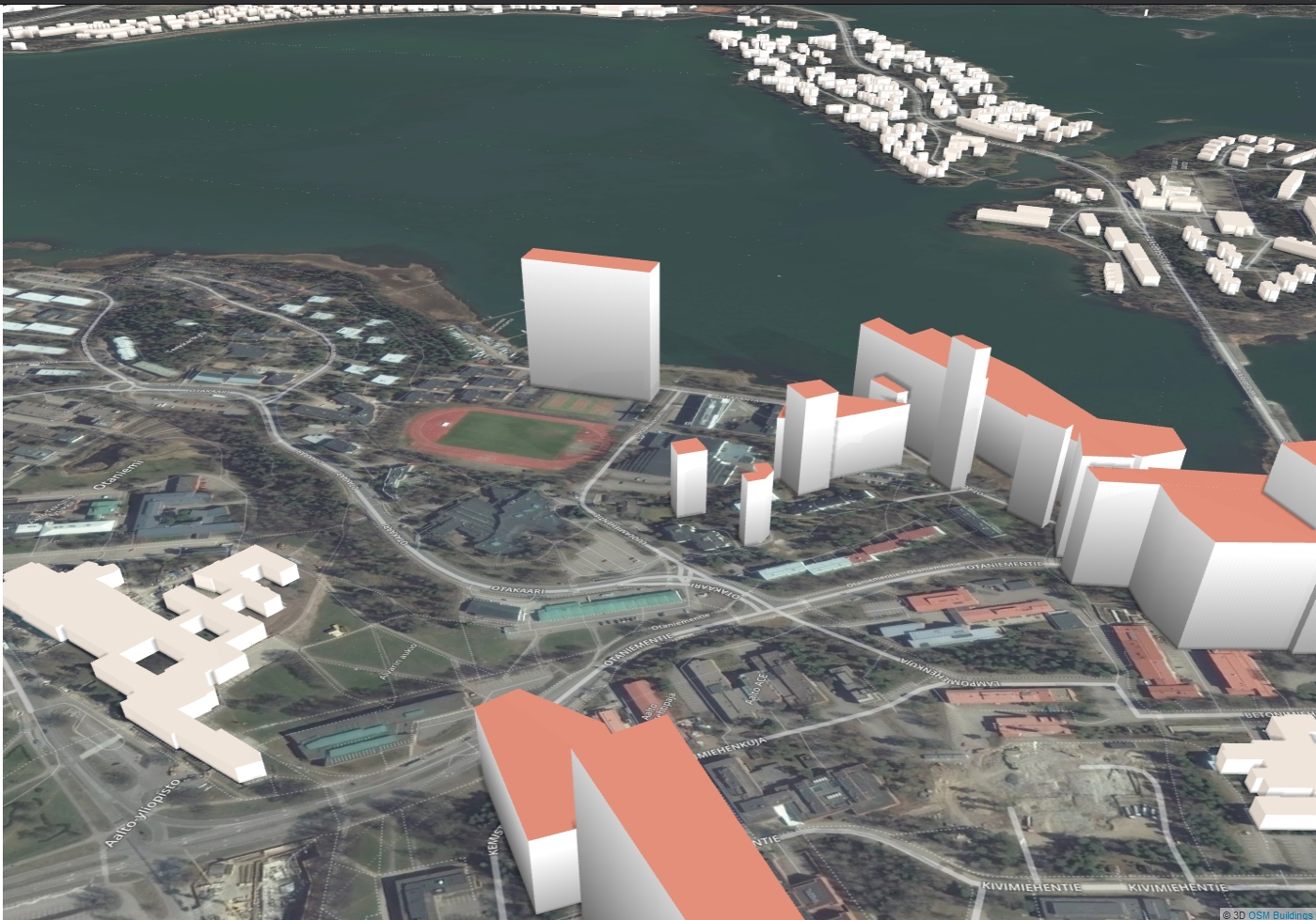
And in a different view:
User interface
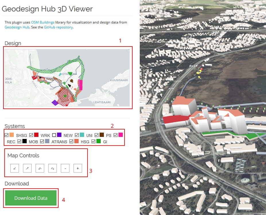
The plugin provides a bunch of controls for you detailed below:
- A 2d representation of the map as drawn in Geodesignhub
- Filtering of systems so you can turn on or off specific views
- Ability to move the camera
- Download data as GeoJSON so you can use it in other 3d softare
- Show existing buildings in the area using OSM data. This is a optional feature provided by OSMBuildings.
How fast is it?
The software is blazing fast and is almost instantaneous, it is deployed as a software service on Heroku and once the plugin launches you will see the scene almost immediately.
What is the technology?
We use the amazing OSM Buildings technology to power this. OSM Buildings is built and maintained by my friend / colleague Jan in Berlin and is very performant has excellent documentation and their company provides a lot of services based on this viewer and OSM data.
When to use it?
This plugin is provided for free for your project on Geodesignhub you can add it using the Administration interface.
Contribute
OSMBuildings and this 3D Viewer plugin is provided for free as a open source project. They are built and maintained by a small group of dedicated teams that have a passion for the craft.
Programmers: I would encourage you to contribute to these projects, you will really get to know about the intricacies of 3D rather than just learning how to click buttons or write scripts and up your 3D game.
Others: Of course, contributions need not only be in code, you can engage in a number of ways, writing documentation, reaching out to authors, providing feedback and supporting these projects. This is the only way to maintain a healthy ecosystem and contribute.
About Geodesignhub plugins
Geodesignhub provides a very extensive API where everything in the software can be taken out for use with other tools. All plugins including the one above use this API to export data out of Geodesignhub. This enables us to provide “one-click” integration with Geodesignhub, so you can focus on the problem at hand rather than software. If you have the skills and resources to use commercial 3D software of course you are welcome to use them, all the data is available for you!
Footnote
For a detailed background about 3D in Geodesignhub, please review this powerpoint, I will write about the other 3D viewer at another time.