ESRI recently released a new platform to integrate ESRI maps, data and location services to external applications. In this article you will learn how to add ESRI basemaps to your Geodesignhub project. When you engage with us on a project via our comprehensive support, we can set all of this up for you.
This is a two step process:
- Get a API Key from ESRI
- Use that key in Geodesignhub
Step 1. Get a ESRI API Key
-
Go to the ArcGIS Developers portal and create a account, if you have an account, you can sign in.
-
Once you have logged in, you will need to create a new API key for your ArcGIS account.
-
You can name it specific to a project or use the key for any Geodesignhub project, make sure you name it appropriately.
-
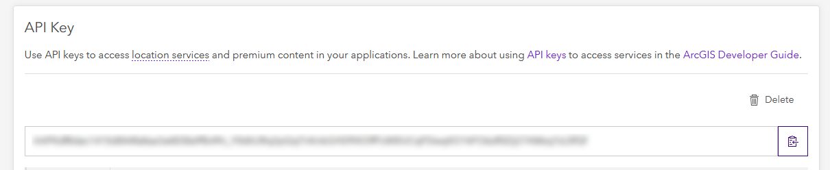
This key must be kept secret and is used in Geodesignhub to link the base maps. Copy it to your clipboard
-
At the moment ESRI provides a series of amazing basemaps and you can choose from any of the following:


- Streets
- Topographic
- Oceans
- OceansLabels
- NationalGeographic
- Physical
- Gray
- GrayLabels
- DarkGray
- DarkGrayLabels
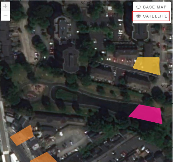
- Imagery
- ImageryLabels
- ImageryTransportation
- ImageryClarity
- ImageryFirefly
- ShadedRelief
- ShadedReliefLabels
- Terrain
- TerrainLabels
- USATopo
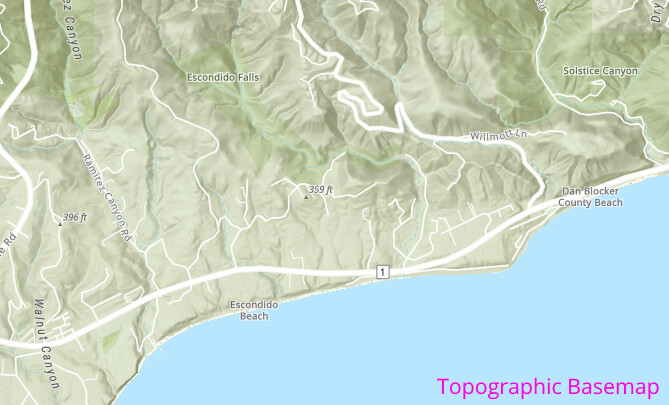
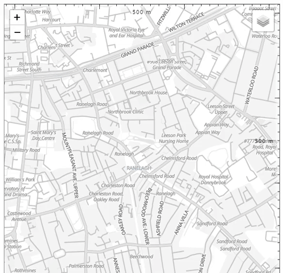
To see all of this in action, you can go to the ESRI showcase and explore these layers for your study area. Two of my favorites are “ChartedTerritory” and “Topographic”
Step 2: Use ESRI API key in Geodesignhub
You will need to be a project administrator to add these layers, you can ask your administrator to add these if you don’t have administration privileges.
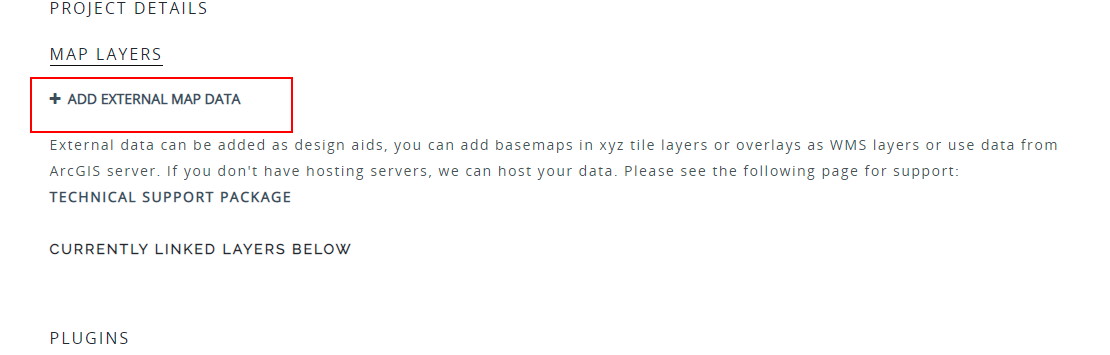
- Once you have the key, go to the Administration Panel and click on the “Map Layers” and then “Add external map data”
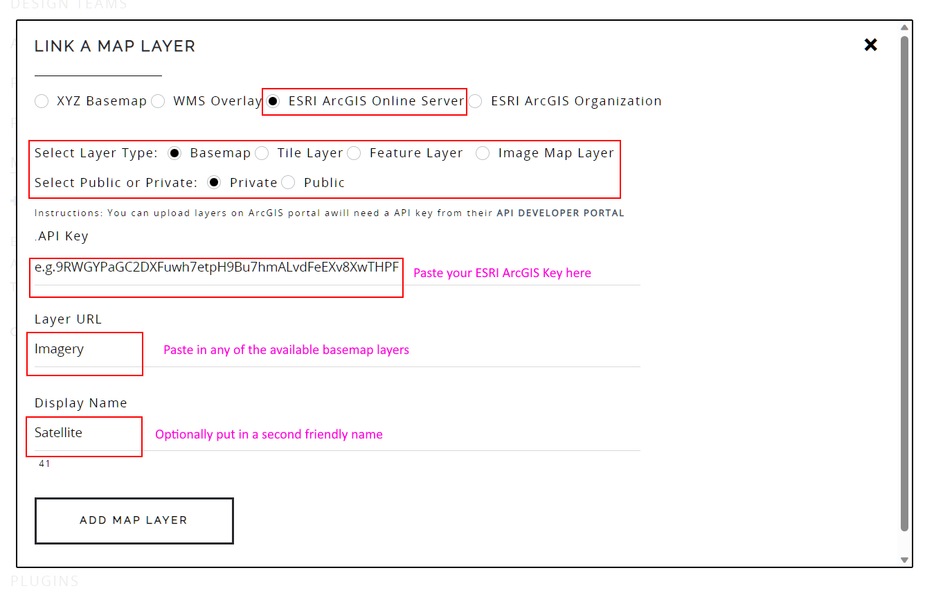
- Then choose “ESRI ArcGIS Server” and then “Basemap”, finally paste the API Key, the name a of the layer (from the list above) and a optional friendly name.
-
And that’s it! The base layer should appear in Geodesignhub as layer in your layers panel!
-
You can add multiple layers to suit your project requirements!
This is just the beginning of many such integrations with the ESRI platform in the coming months! ![]()
![]()