Plugin Showcase
Geodesignhub follows Python’s premise of “batteries included”. What it really means is to have a rich, standard functionality that can be utilized without having the user to download various packages or installing software or worrying about software licenses, technical skills etc. This gives Geodesignhub a head start in many projects because the focus is on the problem at hand and not software requirements or technical skills etc. To that end, we have built and maintained a extensive set of plugins and tools. Plugin Showcase is a series of posts that I plan to write over 2019 to introduce the different plugins that are available in Geodesignhub today that you can use for your projects.
Introduction
Geodesignhub is used as a management support tool in the context of geographical projects. The most important thing about it is that it facilitates negotiations. In any negotiation, the language used is critical. We see this often in declarations, agreements etc. The language and the text used and it’s literal meaning and “the spirit” matters.
We use Geodesignhub to facilitate negotiations about the future of a space. It used as a way to run meetings with different stakeholders to negotiate and come to a consensus. In this context, interventions and ideas are expressed as simple diagrams on a map. You can review the “What is a Diagram?” article for more information.
At the end of the negotiations, a set of diagrams are agreed upon and we call it a “design”. Given that these representations are digital, we can use advances in computing to develop a deeper understanding. So what can we do with something like this? The figure shows at a high level kind of the analysis that you can do over a set of ideas in a space.
Basically, two types of analyses are described above:
- Text based: To analyze the words and text used to describe the negotiated outcome
- Spatial Analysis: Analysis of where on a map are these ideas.
This plugin specifically focuses on the first aspect i.e. analyzing the text “Taxonomy” and “Conceptual” similarity, I will write about spatial analysis at a later date. Once you add the plugin to your project it is available as a “single click” integration.
Details
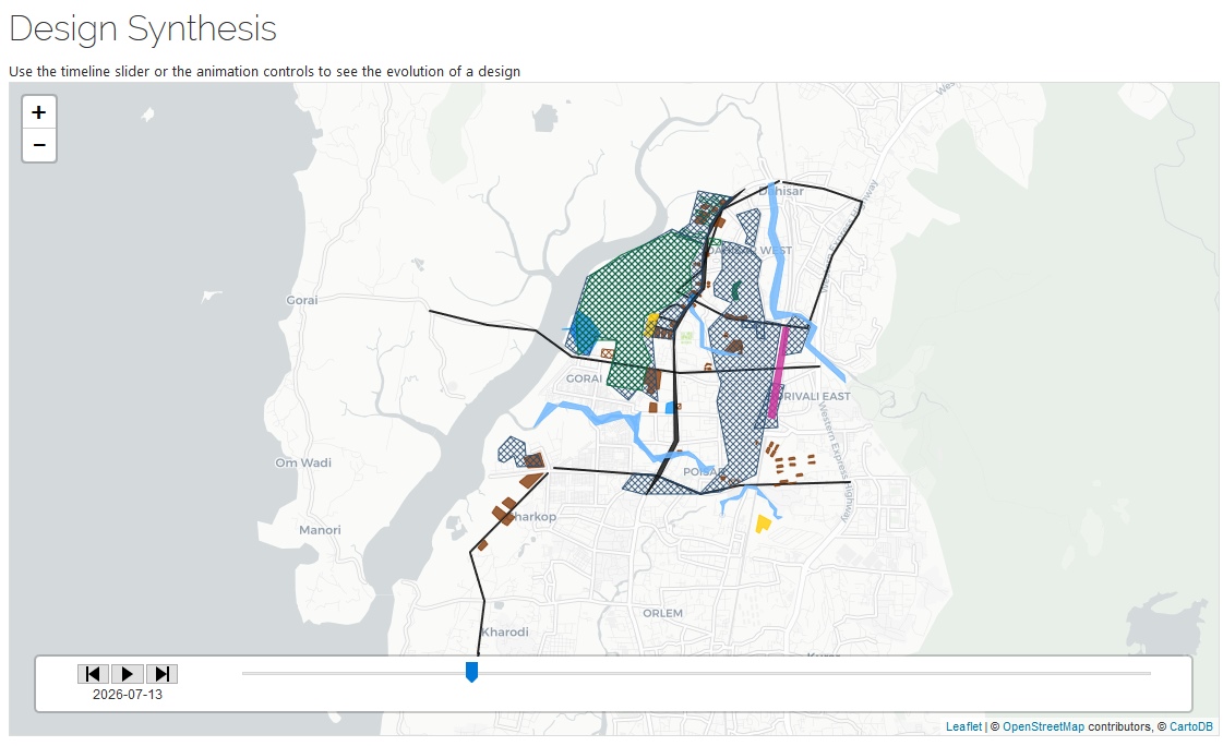
First it shows a list of the all the negotiated outcomes on a map as as timeline and as a table.

Then we analyze the titles to build a word cloud for the most important “concepts” to get a high level overview and get the group thinking on the same page.
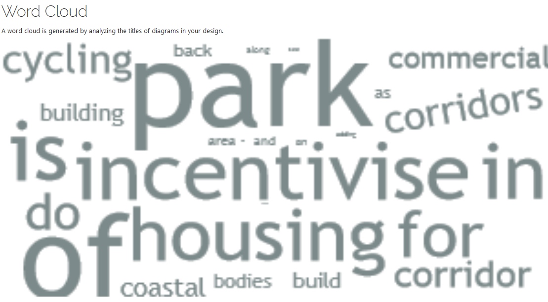
The table is grouped and has start and end date for each of the diagrams. The combination of showing it as a map, a grouped list and a wordcloud orients the participant on the key ideas that are agreed upon. Then it gets interesting.
Semantic Analysis
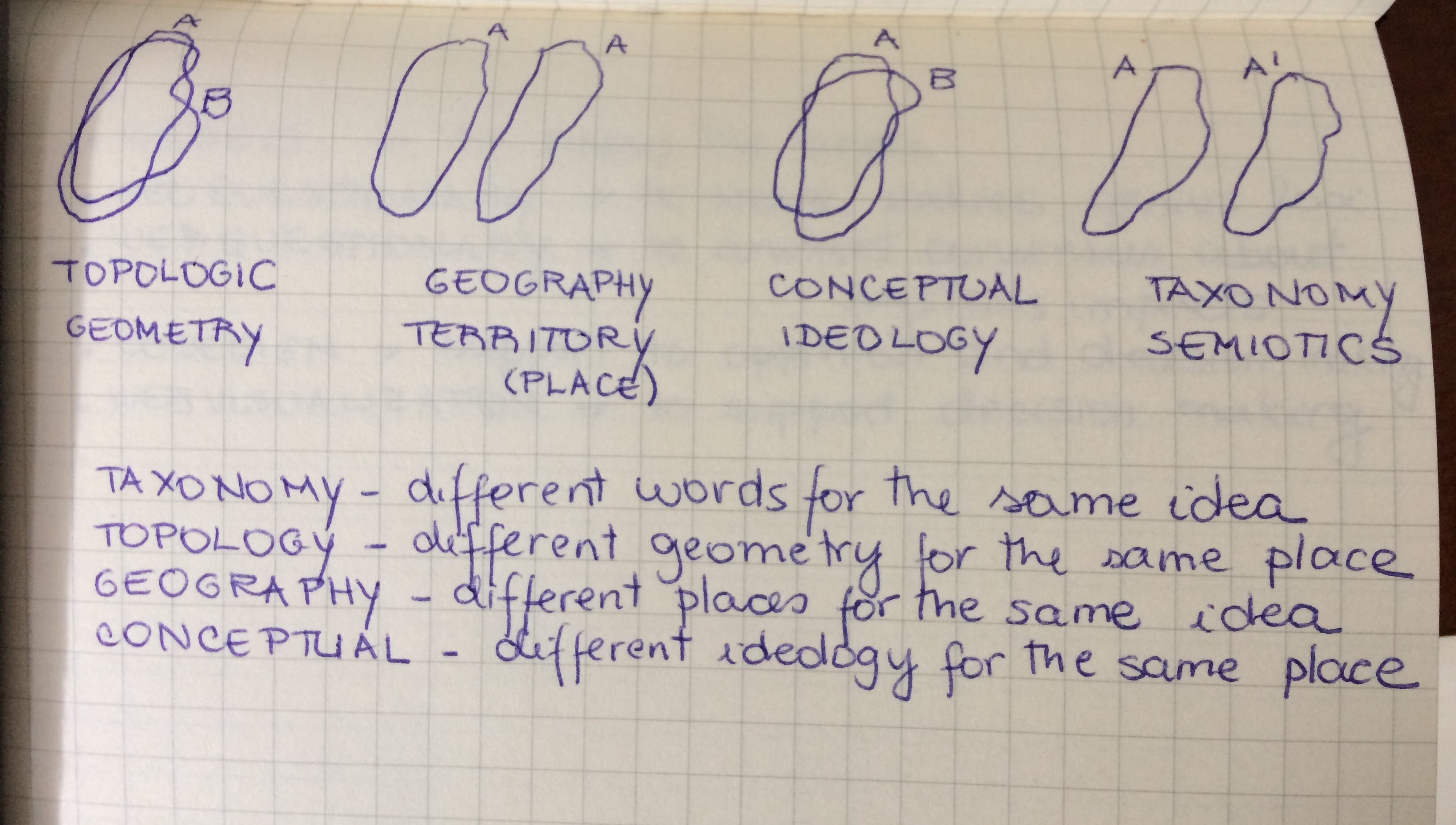
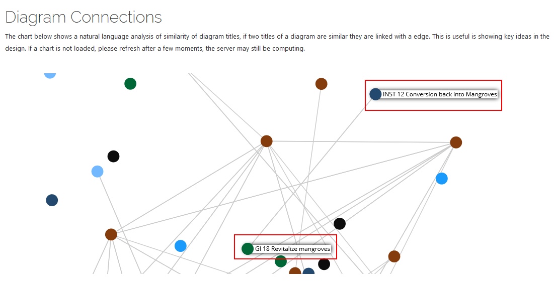
The diagrams are built by different people from different departments, professions and interests and often they talk about a concept in different ways: e.g. mobility and transport are conceptually “the same” but depending on who talk to they will use the different words depending on what they are used. So we analyze the titles listed above using the natural language analysis to understand these links and build a graph like below:
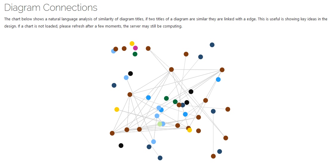
The nodes are the individual diagrams and the links are added if the software thinks that they are connected. For example here is some one saying that the institutional entities need to convert this back to mangroves and someone else saying that mangroves need to be revitalized, these are the same ideas and you can see how these ideas are similar although it may be that the two people who wrote it have never met or be in a position where they don’t work together. By demonstrating that they share same values, we open a basis of a working relationship.
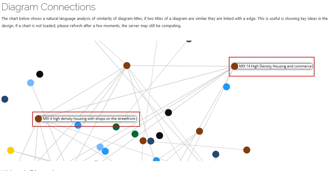
Another example is how people describe housing and mixed use developments:
Why is this important?
In many cases, people are really talking about the same thing but they way they describe it is slightly different. How do we demonstrate this transparently? We use technology for this.
Geodesignhub is a software used in negotiations and often times people are saying the “same thing” but in different ways and this creates a illusion that the other person is saying something that might be incompatible but using technology and semantic analysis we can demonstrate that they are similar and help people build a common ground and a nuance about their positions. This helps in co-ordination and getting people on board with other ideas.
Caution
There is a reason this post is called the “Frontiers of Geodesign”: conversation, communication and describing a concept is a art. Some people are naturally better communicators than others. The technology here assumes that the titles and text is clear precise and comes from someone who has some experience in naming things appropriately. We have seen that the results of this depend largely on how well the ideas are described i.e. the text used.
What is the technology?
This is a open source plugin and you can take a look at the code on the link. But basically it is using Geodesignhub API to download all data from Geodesignhub and then uses primarily the Natural Language Toolkit to build this. You can get really deep in to semantic analysis, sentiment analysis etc. but all of that can be used in this context.
Contribute
If you are interested in sentence or sentiment analysis of the way people describe things, this is a invitation to contribute to this by engaging with me or the community. At the moment it works well with English since it uses the NLTK default corpus. Geodesignhub is used all over the world with many kinds of problems and communities and of course supports many other languages, we have not really tested this on non-english languages but it would be a very interesting next steps.
About Geodesignhub plugins
Geodesignhub provides a very extensive API where everything in the software can be taken out for use with other tools. All plugins including the one above use this API to export data out of Geodesignhub. This enables us to provide “one-click” integration with Geodesignhub, so you can focus on the problem at hand rather than software. If you have the skills and resources you can use it to build or import into your own tools.