Constraints are areas in a design that should be touched or changed. These are represented as polygons and can be either drawn in the tool or be imported from a Shapefile. This article will focus on how to setup a constraints Shapefile so that it can be converted to a GeoJSON file and uploaded to Geodesign Hub.
Constraints are areas usually drawn from existing land use or land cover data. These can be natural features like lakes, rivers, or footprints of protected buildings etc. A sample constraints file is here.
-
Select features that you want to act as constraints for your design project from the existing data.
-
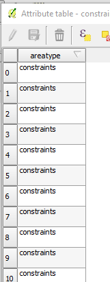
In the attribute table, clear all columns and create a new column called ‘areatype’ and fill the value as ‘constraints’
-
Finally convert the Shapefile as GeoJSON.
-
If the file is more than 100kb, it is recommended that you simplify the features to ensure fast processing. Please review the simplification article for shape simplification.