Geodesign in Cromane, Co. Kerry. October 2017.
Cromane (An Cromán, meaning the hipbone – the shape of which, Cromane Point resembles) is a coastal community on the northern side of the Iveragh Peninsula, just off the Ring of Kerry. Aquaculture is the single largest economic activity locally, and the interface between economy and environment is most important. Like many rural communities, Cromane has been affected by changes in agriculture, the loss of public services, underinvestment and a consequent ageing of the population. However, the community has very high levels of social capital and a strong tradition of volunteerism. Community and voluntary groups have had tremendous achievements and they provide a range of social and recreational amenities locally. Building on its community development credentials, but conscious of demographic and economic pressures, Cromane Community Council took the decision, in 2017, to formulate a development plan for the locality. The Community Council formed a Socio-Economic Sub-Committee, whom it charged with the task. This Committee in turn received funding from the FLAG (Fisheries Local Action Group), which is administered by BIM (Bord Iascaigh Mhara). This grant enabled it to compile the plan and to engage Paul O’Raw (Independent Consultant) to facilitate the process. Following the compilation of a socio-economic and demographic profile and two well-attended public meetings, the people of Cromane identified six development themes, and they decided unanimously to embark on a Geodesign Workshop in order to agree strategies and specific actions in respect of these themes. Moreover, they opted for the Geodesign methodology in order to identify optimum locations for future developments and to visualise what their community would look like.
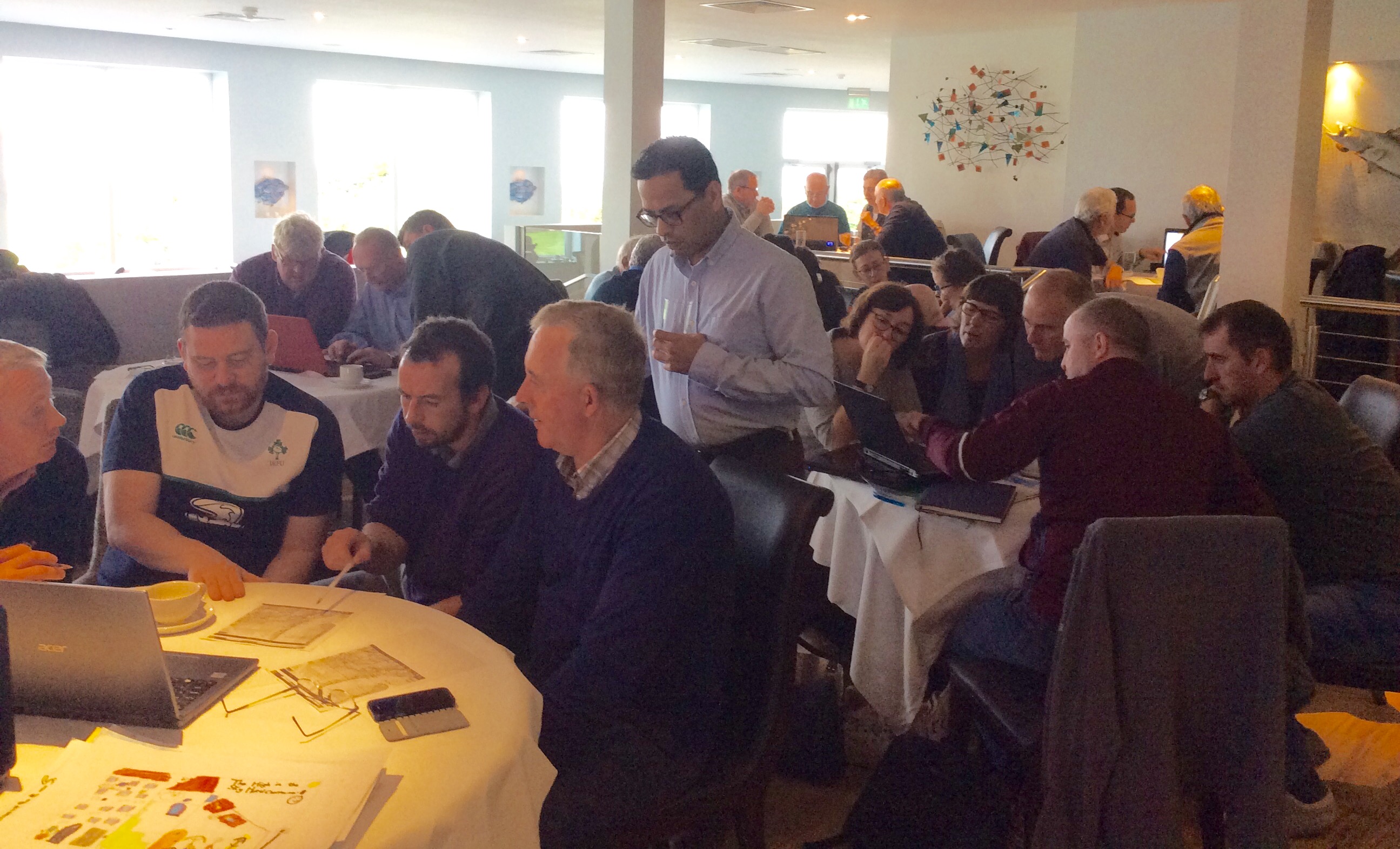
On October 7th, a representative cross-section of about thirty people came together for the Geodesign Workshop. They did so under the guidance and facilitation of Dr. Hrishikesh Ballal, who is the Managing Director at Geodesign Hub. Dr. Ballal had previously worked with other rural communities, including with Mulranny, Co. Mayo – a place that has much in common with Cromane. Thus, he came highly recommended. In advance of the Workshop, Dr. Ballal had liaised with Kerry County Council, and specifically with Darren Burke in the Planning Department, in preparing base maps and in identifying development parameters. In parallel, the people of Cromane had been organising themselves into working groups of 3 – 5 people, with each group focusing primarily on one of the six pre-selected themes, namely: Community Facilities, Environment, Fishing / Marine (including developing a local pier), Tourism, Culture & Heritage and Transport. In preparing for the Workshop, the local community had found a suitable venue with WiFi – the comfortable and hospitable, Jack’s Coastguard Restaurant.
Following a welcome and introduction from Liam Hayes, Chair of the Socio-Economic Group, Hrishikesh went through the format for the day and expertly guided participants through the Geodesign methodology. Using a ‘sandbox,’ he enabled them to get familiar and comfortable with the Geodesign interface, and they very quickly demonstrated their competence in map-making and expressing their visions using the bespoke software. Having acquired the requisite technical know-how, the workshop participants, who were sitting at roundtables considered, discussed and elaborated specific developments and projects in respect of their thematic areas. In doing so, they drew on the discussions that had been had at community meetings and the results from a community vibrancy study that had been undertaken locally some weeks previously. Thus, being well-prepared and well-informed in advance were integral to the smooth running of the Geodesign Workshop. The process is not for passengers or observers, but provides, instead, a framework and structure for active and collaborative participation.
Having identified and mapped almost 60 projects or actions, the groups then came together to form three larger groups – representing, in broad terms, community interests, economic interests and statutory agencies. This reconfiguration enabled further dialogue and the generation of synergies as Hrishikesh facilitated a set of negotiations in which sometimes competing and sometimes complementary interests and projects were presented to the entire room. This element of the Geodesign Workshop provided for further refining of project proposals and increased levels of specification in respect of project scale, locations and inter-relations. The output of this process was a composite map containing the agreed set of development projects. This complemented the impressive database of project-specific maps that had been elaborated over the course of the day. Bringing the proposals together enabled the community to make more informed decisions in setting priorities and it demonstrated how potential projects could possibly affect one another. In following-up on the Geodesign Workshop, Cromane Community Council will host a drop-in consultation session at which the maps and project proposals will be on public display and at which members of the local community will have further opportunities to contribute to the formulation of the area development plan.
Geodesign has furthered the capacity of the people of Cromane to collaboratively and constructively engage in dialogue, advance proposals and take decisions regarding the development of their local community. It has been a worthwhile experience, having been situated within a sequenced set of facilitated and community-led interactions. The community is all the better for having come to know Hrishikesh and the Geodesign methodology.
Dr. Brendan O’Keeffe
November, 2017.